Ημερολόγιο συνεδρίων, εκθέσεων, ημερίδων. Επιλέξτε προβολή ανά εβδομάδα για μεγαλύτερη λεπτομέρεια.

Δευτέρα 7 Σεπτεμβρίου 2015

Job at British Antarctic Survey

The British Antarctic Survey is seeking to appoint an enthusiastic GIS
specialist with a background in geography, geo- or environmental sciences to
work in the Mapping and Geographic Information Centre.  The role is a
three-year fixed term appointment and will contribute to a range of GIS and
mapping projects supporting BAS Polar Operations and the UK Foreign and
Commonwealth Office Polar Regions Department.

Full details are available at:
https://www.bas.ac.uk/jobs/vacancy/gis-officer/

The closing date is 13 September 2015.

Πέμπτη 26 Φεβρουαρίου 2015

Associate Professor/Professor of Remote Sensing - University of Southampton

Associate Professor/Professor of Remote Sensing

University of Southampton : Geography and Environment

Research Group : Global Environmental Change & Earth Observation
Salary:   £47,328 to £63,449
Full Time Permanent
Closing Date:   Sunday 22 March 2015
Interview Date:   Thursday 07 May 2015
Reference:  510115WR

Geography and Environment are inviting applications for a
Professor/Associate Professor of Remote Sensing. Of particular interest are
candidates with an international reputation of research excellence who can
complement and expand our existing research areas within the Global
Environmental Change and Earth Observation research group :

http://www.southampton.ac.uk/geography/research/groups/global_environmental.page?.

You will be expected to establish an externally funded research program as
well as contribute fully to both undergraduate and graduate teaching.

Current research within Geography and Environment has a strong emphasis on
interdisciplinary initiatives that bridge traditional disciplinary groups to
address challenging problems. We are dedicated to maintaining our
world-leading reputation in remote sensing and we are now seeking a new hire
who has research interests that will enhance existing specialisms within the
group, and complement those in other Research Groups both within the
Department, and more widely within the University.

Salary and level of appointment will be commensurate with qualifications and
experience.
Interviews will be held on Thursday 7 May 2015.

Informal enquiries can be made to the Head of Academic Unit, Professor
Stephen Darby (S.E.Darby@southampton.ac.uk).

Further details of the application procedure can be found on the Southampton
University website :
https://www.jobs.soton.ac.uk/Vacancy.aspx?ref=510115WR


Δευτέρα 2 Ιουνίου 2014

Research Studentship (MPhil) in Novel platforms and applications for Ground Penetrating Radar


Title: Funded MPhil Studentship
School/department: Geography 
Supervisors: Dr Booker Ogutu and Prof Heiko Balzter
Start Date: 01/07/14 at the latest- earlier preferred
Entry Requirement: UK/EU only – first degree (BSc) obtained in last three years only
Closing Date: 01/06/14 (extended until 8 June)


Applications are invited for a 12 month research studentship in Novel platforms and applications for Ground Penetrating Radar funded by the European Regional Development Fund (ERDF)- IRSA grant, the University of Leicester and Sterling Geophysical Surveys Ltd.

The MPhil studentship will cover a maintenance grant for 12 months and a small amount for research expenses and travel. Full University student fees for UK/EU students for will be covered by Sterling Geophyscial Surveys Ltd. Interested applicants are encouraged to contact Dr Booker Ogutu for an informal discussion on 0116 252 7496 or by email to boo7@le.ac.uk.
The student will be based in the department of Geography, University of Leicester (http://www2.le.ac.uk/departments/geography). The student will be encouraged to complete all aspects of the MPhil including submission by the end of the 12 month grant period.

Project Overview (as below or similar)

The project will use data collected by the student from both ground based Ground Penetrating Radar (GPR) and UAV mounted GPR equipment. The project will cover the following areas:

1. Techniques for analysing and estimating the accuracy and precision of data from UAV mounted GPR.
2. Test the applicability of existing georeferencing methods on the data collected by the UAV mounted GPR.
3. Research the different factors causing inaccuracy and error, and make recommendations to resolve identified issues and problems.
4. Evaluate the applicability of the UAV mounted GPR in determining peat depths.
5. Produce a final report suitable for submission for an MPhil award.

The University of Leicester has access to a number of sites that could be used to carry out field work and collect data. These include, a GPR test site, the site of a Roman villa that the Department of Archaeology are currently working on, and an area of extensive peat bog-land of interest to the Geography Department

Entry Requirements
Applicants must have a first-class or high upper second-class honours degree (or equivalent qualification) obtained in the last three years (2011, 2012, 2013 BSc graduates) in Geography, Geology, Geophysics or Surveying or a closely related subject and and complete the university online application process on http://www2.le.ac.uk/study/research/how-to-apply/online
Students must meet the University’s standard English language entry requirements.

This studentship is only available to new applicants who are permanently resident in the UK or another EU country. The studentship is for full-time study only and applicants must be able to commence their studies by 1st July at the latest.

Details of IRSA can be found at

Date of advertisement: 5th May 2014
Closing date for applications: 1st June 2014 (extended until 08 June)
Shortlisting of candidates on 2nd June 2014, invitations to interview
Interviews will be held on week beginning 9th June 2014 and we anticipate making an offer within 24 hours of interview.

Πέμπτη 3 Απριλίου 2014

What can we look forward to from WorldView-3

DigitalGlobe is a big player in the provision of satellite imagery, so it’s no surprise that the earth observation community is looking forward to the launch of their new satellite, WorldView-3. The company already operates a constellation of satellites that are widely used in commercial image analysis (QuickBird, WorldView-1 and WorldView-2http://www.digitalglobe.com/about-us/content-collection#overview). But besides the obvious benefits of more satellites giving greater coverage of the Earth’s surface, what other benefits will WorldView-3 be bringing to the party?
Well first, a bit of background. Like its sister satellites QuickBird and WorldView-2, WorldView-3 (WV-3) is multispectral. This means that it is observing light reflected from the Earth at a number of different frequency bands across the electromagnetic spectrum (unlike WV-1 which only observes one bands of frequencies, i.e. panchromatic). Typically these bands are sited within the red, green and blue portions of the spectrum, with a fourth band within the Near Infra-Red (NIR). The three RGB bands allow us to produce images as the human eye would see, whilst the NIR band is useful for delineating features such as land/sea boundaries or identifying clouds -- basically any feature where we’d expect a sudden change in temperature. This is the approach of QuickBird and many other commercial satellites. 
 
 WorldView-2 takes this approach a little further, by utilising 8 bands in the Visible and NearInfra-Red spectra (VNIR). I’ve listed the bands used by all of these satellites in the accompanying table. We can see that as well as the standard RGBand NIR, WV-2 has some additional bands -- Coastal Blue, Yellow, Red Edge and a second NIR band. Each of these bands is chosen to be sensitive to a particular feature on the surface. For example, the Coastal Blue band is more sensitive to moisture within an image than the traditional Blue band, so it can be used to improve on water depth measurements around harbours. These additional bands really help with image analysis because the additional information allows for more accurate image classification and segmentation which would be carried out with analysis software such as ENVI. 
WorldView-3 takes the advances made with WorldView-2 the next step forward and includes 8 more bands within the Short-Wave Infra-Red (SWIR) region of the spectrum (http://www.satimagingcorp.com/satellite-sensors/WorldView3-DS-WV3-Web.pdf), in addition to the VNIR channels of WorldView-2 (also listed in the table).  This allows WV-3 to observe a much wider range of the electromagnetic spectra than most other commercial satellites, and will allow us to start looking for the individual spectral signatures of materials. The accompanying plot shows the spectral signatures of three minerals. The light blue regions on the plot denote the VNIR bands covered by WV-2and WV-3. The light red regions denote the SWIR bands covered by the 8 new WV-3 bands. This shows just how much further the new bands penetrate into the electromagnetic spectrum. The spectral profiles of each pixel in an image can be compared to a spectral library (such as the reflectance spectras shown) to classify what material is contained within that pixel.
 
This type of automated spectral classification is commonly carried out in ENVI with hyperspectral data (from satellites containing hundreds of spectral bands) which can sometimes be costly to acquire. However, the ability to remotely monitor materials is invaluable to a great number of industries for example in forestry applications where we see users wanting to monitor tree health and pest infestation in remote regions. WorldView-3 brings a limited version of this capability to users at a reduced price, so we still won’t expect the accuracy of a hyperspectral satellite, but it really is a step beyond the features we could extract from multispectral data. So, I’ll stick with Digital Globe’s marketing and refer to it as ‘super-spectral’.
WorldView-3 will be launching in the next few months, so the first data is likely to be available at the beginning of 2015. As a partner of Digital Globe, we’ve been preparing for this. In fact, our parent company developed the SWIR sensor aboardhttp://www.exelisinc.com/news/pressreleases/Pages/Exelis-delivers-first-of-its-kind-commercial-payload-to-DigitalGlobe-for-WorldView-3-satellite.aspx). The data will be able to be loaded into ENVI as soon as it’s available, so I advise you to keep an eye out for further updates because this instrument looks like it will be a great addition.


Κυριακή 2 Φεβρουαρίου 2014

Vegetation Analysis Via SkySat-1 Near Infrared Imagery

By Ty Kennedy-Bowdoin, Processing Platform Product Manager


SkySat-1 collects imagery using 5 channels: blue, green, red, near infrared (NIR), and panchromatic. Everyone is familiar with the first three channels because the human eye is sensitive to this range of the electromagnetic spectrum and our brains have evolved to interpret this information intuitively. For this reason, cameras and satellite data are typical viewed in this “true-color” scheme that we see in platforms like Google Maps.

The NIR channel (740 - 900 nm) is designed to capture light in a range just beyond the visible spectrum (390 - 700 nm).  To visualize a “color infrared” image we typically map the NIR channel to red, while assigning the red to the green and the green to the blue channels. This allows us to visualize the near infrared channel as red, so materials that reflect well in this wavelength range appear very red. 

One of the more interesting characteristics of the NIR channel is that lush vegetation reflects very strongly relative to other materials or woody vegetation. Healthy vegetation generates more chlorophyll in the leaves, which reflects well in the NIR, while less healthy leaves are much less reflective. Many interesting metrics depict vegetation health based on ratios of the red to NIR channel. 

One of the most common vegetation health metrics is the Normalized Difference Vegetation Index (NDVI) which works well in consistently vegetated areas. The Modified Soil Adjusted Vegetation Index (MSAVI) takes this metric one step further by correcting for the amount of exposed soil in each pixel in agricultural areas where vegetation is surrounded by exposed soil. 

The example in Figure 1 illustrates a color infrared rendering of some center pivot irrigated fields in Saudi Arabia. Figure 2 illustrates the MSAVI results from this same dataset. I have rendered the colors to depict healthy vegetation with hot colors and less healthy vegetation in cool colors. While we could qualitatively determine that one of the center pivot irrigated fields was well watered and the others appear to be fallow in the color infrared image, we now can quantify this with metrics that can be compared throughout the seasons or years and correlated with the factors measured on the ground like water usage, fertilization, seed varieties, crop yield, etc. 

Mineral deposits rich in Iron Oxide are another common source of reflective NIR values in satellite images. This can be very interesting to geologists searching for assemblages of minerals indicative of higher concentrations of valuable metals.

This is only the beginning of what we can do multispectral imagery! Interested in learning more? Feel free to reach out to me at ty@skybox.com


Figure: MSAVI Results of a Center Pivot Irrigated Field in Saudi Arabia. Captured by SkySat-1 on 12/26/13.

Ball Aerospace satellite readied for launch by DigitalGlobe


WorldView-3 spacecraft to enhance Longmont firm's high-resolution imagery capabilities
By Charlie Brennan, Camera Staff Writer
The WorldView-3 remote sensing satellite, built by Ball Aerospace & Technologies Corp. for DigitalGlobe, being prepared for launch this summer. 
Ball Aerospace & Technologies Corp. has completed assembly of its WorldView-3, the fourth remote-sensing satellite it has built for DigitalGlobe, scheduled to launch this summer from California's Vandenberg Air Force Base.
The WorldView-3 spacecraft is billed by Ball Aerospace as the first multi-payload, super-spectral high resolution commercial satellite for Earth observations and "advanced geospatial solutions."
Ball, in addition to the satellite bus, will provide an atmospheric instrument that it calls CAVIS -— Cloud, Aerosol, Water Vapor, Ice, Snow.
CAVIS, integrated with the spacecraft, will monitor the atmosphere and provide correction data to enhance WorldView-3's imagery when it documents Earth features through dust, haze or other things that might impair visibility.
DigitalGlobe, based in Longmont but moving to Westminster next year, claims to own and operate one of the most agile and sophisticated collections of high-resolution commercial Earth imaging satellites in the world, capable of collecting more than 1 billion square kilometers of high-quality imagery every year.
WorldView-3 is described by Ball Aerospace as building on WorldView-2 and WorldView-1 technology by enhancing the satellite's control moment gyroscopes, which reorient a satellite over a targeted area in 4-to-5 seconds, compared to the 30-to-45 seconds required for traditional reaction wheels.
WorldView-3 utilizes the Ball Configurable Platform BCP 5000 spacecraft, which is designed to handle the next-generation optical and synthetic aperture radar remote sensing payloads, and is currently meeting or exceeding all its performance specifications on the WorldView-2 satellite.
Companies 'have grown up together'
For Jeff Dierks, Ball Aerospace program manager for WorldView-3 and its predecessor, WorldView-2, the next step in its partnership with DigitalGlobe only further cements what has been a rich relationship since the early 1990s.
"We have grown up together with them," said Dierks, noting that there has been cross-pollination in staff between the two companies since not long after DigitalGlobe was founded in 1992 as the WorldView Imaging Corporation.
In 1995, WorldView became EarthWatch Incorporated, merging with the BallAerospace commercial remote sensing operations, becoming DigitalGlobe in 2001.
"What's exciting is watching the business grow over the years," Dierks said. "DigitalGlobe has become quite a successful company, and is a remarkably different company than when they first started both in size and success."
And it has been fruitful as well for Ball Aerospace, which Dierks said was paid "a little over $200 million" for its design and build of the WorldView-3 spacecraft and CAVIS instrumentation.
Kumar Navulur, director of research and development for DigitalGlobe, expressed excitement about the advanced imaging capabilities that WorldView-3 will facilitate.
"There are several advantages with the WorldView-3, compared to our previous satellites," Navulur said. "The first one is the satellite will capture pictures at 1 foot, or 30 centimeters resolution," as opposed to the 50-centimeter resolution afforded by its precursors.
"The only caveat is that today, DigitalGlobe can only sell 50-centimeter to commercial customers. We have asked for a relaxation from the government, but at this point we don't know when we will be able to get it. In the worldwide market, 1-foot images are the sweet spot."
Navulur said WorldView-3 moves DigitalGlobe from multi-spectral imaging (utilizing up to 10 spectral bands) to super-spectral imaging (using 10-20 bands).
And, in addition to recording data in the visible and near-infrared parts of the solar spectrum, Navulur said, WorldView-3 also will be looking into the shortwave infrared spectrum, "where there is a lot more information."
Many uses of imaging data
Navulur cited examples of the data that such imaging will yield, and its applications. For agricultural clients, it will now be possible to look at things such as crop inventory and the moisture content of soil.
Forestry clients will be able to conduct inventories that differentiate not only between coniferous and deciduous trees, but between trees species.
Wildfire managers will be able to detect hotspots, which could have life-saving implications if firefighters can be steered away from lethal pockets.
And miners and geologists will be afforded a much better picture of the presence of mineral deposits, while those in the oil and gas industry will realize a similar benefit, Navulur said.
WordView-3 will be moved to its California launch site about two months before its summer liftoff, and integrated with its Atlas V rocket —- manufactured by United Launch Alliance, another Colorado company — and readied for delivery into its orbit altitude of 617 kilometers.
It should start collecting data about 45 to 90 days after launch, Navulur said.
Contact Camera Staff Writer Charlie Brennan at 303-473-1327, brennanc@dailycamera.com at twitter.com/chasbrennan.
 

Παρασκευή 12 Ιουλίου 2013

Learn How Location Analytics Drives TBC Corporation (Midas, Big O Tires, Speedee) in the Retail Automotive Industry


Attend this webinar to understand how TBC Corporation – one of the nation's largest marketers of automotive replacement tires through a multi-channel strategy, including retail and wholesale distributors - continues to stay ahead of the curve through a combination of business smarts and spatial analytics using Alteryx.
Just The Facts
With over 2,700 franchise and company-operated locations operating under the brands Midas, Big O Tires, Speedee Oil Change & Auto Centers, Merchant’s Tire & Auto Centers, National Tire & Battery and Tire Kingdom, TBC uses the power of Alteryx to provide analytics insights to all levels of the organization.
 
Key Takeaways
This webinar will include a live demo of Alteryx Strategic Analytics, the platform that TBC uses to anticipate key market trends, and successfully capitalize on them at every turn. Alteryx has a rich history with spatial analytics and provides analysts with the ability to:
  • Integrate location-based and predictive analytics with demographic and firmographic data, on a single platform
  • Deploy location analytics including interactive mapping in the cloud – without IT involvement or costly licenses
  • Work with a wide variety of file formats, including SHP/MDB (ESRI), MID/MIF (MapInfo), KML (Google), and many more
Speakers include:
  • Marcy Cautreels, Manager, Strategic Analytics, TBC Corporation
  • Dipesh Patel, Director, Product Marketing, Alteryx
Who should attend
This session is for both spatial experts and novices. It’s intended for anyone interested in location-based demographic analysis, franchise organizations’ use of spatial analytics, deploying spatial analytics as cloud-based applications, and/or Alteryx tools specifically.
Register Now

Δευτέρα 10 Ιουνίου 2013

Clickable history: Researching the Byzantine Empire with GIS


Almost nothing persists to reveal the existence of Jews in the Byzantine Empire – no buildings or synagogues, coins or seals, pots or pans, charms or amulets. Such evidence of everyday life simply hasn’t survived for this now-vanished people, despite their living in a region that stretched from the southern Balkans, across Turkey to Crete and Cyprus for almost a millennium until the late 15th century.
Yet, evidence there is – if you look hard enough: inscribed on toppling tombstones, referenced in medieval travelogues and documented in fragments of Hebrew manuscripts that have only recently been deciphered. But because these threads are scattered so widely, often inaccessibly or in fragments, Byzantine Jewry has been largely neglected in histories both of the Empire and of the faith.
Now, new research is not only filling these gaps – and, in so doing, showing how the Jewish population had a distinctive identity and unique culture – but is also breathing new life into the sources. The key to the approach is the use of a geographic information system (GIS). Similar to the advanced technology that underpins Google Maps and the global positioning systems now used in millions of cars, GIS combines a relational database with an interactive map. Like these tools, the map is dynamic – when a question is asked of it, the system pulls data from the database to produce a map that gives specific information about a specific location at a specific time.
Although GIS has been around for some 50 years, its use in research had largely been restricted to the geographical sciences. Today, however, the tool is increasingly being used by researchers to map behaviours and events onto the landscape, whether it’s the relationship between the built environment and obesity, or emergency planning for terrorist attacks and natural disasters.
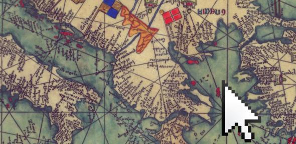
And now, historians such as Professor Nicholas de Lange, who leads the study Mapping the Jewish Communities of the Byzantine Empire in the Faculty of Divinity, are turning to GIS as a means of managing and interrogating complex collections of data that relate to a defined location, and disseminating the information via the internet.
Maps have always been a linchpin of historical study but, as de Lange explained, GIS and the advent of web maps are providing new scope for visualising trends in historical data: “What’s exciting about GIS is it allows us to move into a different dimension. Conventional maps are two dimensional – they show the situation in a geographical area at a given point in time. We are adding a third dimension that frees maps from being static snapshots – it can be viewed backwards and forwards in time, instantly revealing changes.”
“The interactive nature of GIS is ideal for allowing researchers to investigate varied types of information quickly,” added Dr Gethin Rees, who built the GIS-enabled database in collaboration with colleagues at the University of Umeå in Sweden. “Users can assess the relevance of particular places to particular Jewish individuals or communities, and compare the data over whatever time period best suits them.” The resulting website was launched in March 2013 and is freely available to specialists and nonspecialists alike.
“We are trying to tell an historical story through the medium of a searchable map,” said de Lange. “In a history book, the author will inevitably have made judgements about the data they decide to show on a map, and this information can become outdated. GIS circumvents this – our database aims to have all of the data that are currently available, and that becomes available in the future. Inclusivity is important because the relatively unexplored nature of the subject means that it’s impossible to predict all the uses to which historians and other researchers will put the data.”
To this end, research associate Dr Alexander Panayotov, with the assistance of three researchers based in Italy, Greece and Turkey, has been painstakingly assembling data that can be dated and located relating to the presence of Jewish communities in the Empire from 650 until the end of the 15th century.
One of the richest sources of information is the writings of the Jewish traveller Benjamin of Tudela, who passed through Byzantium on his way to the Holy Land in the mid-12th century. His travelogue describes the location of Jewish communities, the number of Jews or Jewish households in each place, their communal leaders, social status, religious schools and sects.
Other sources of knowledge about Byzantine Jewish life include Hebrew inscriptions on tombstones that help to place individuals in specific locations at specific times; deeds, personal correspondence and legal documents, such as the marriage settlement and dowry in 1022 between Namer son of Elkanah and Eudokia daughter of Caleb, which provide social and economic history; and Hebrew manuscripts that contain the date and place of their writing. All the information these provide is being added to the growing database.
To date, around 1,000 separate sources have been analysed, describing over 1,000 individuals living at 150 locations and participating in 100 different occupations.
One of the greatest challenges the researchers have faced is the fact that GIS was designed for use with empirical data – facts and figures that are assured. “When you consider the age-related damage and fragility of many of the medieval sources, precision and reliability are sometimes compromised,” explained Rees. “Given the scarcity of information, even such problematic data cannot be overlooked in a project of this type. Luckily GIS is capable of handling ‘imperfect data’ much better than conventional maps and it’s possible to provide a digital indication of the uncertainty surrounding an event. That way, the user can judge whether to accept the evidence or not.”
The Byzantine Empire is held by scholars to be an important historical link between the ancient empires of Greece and Rome – with their rich cultural and intellectual traditions – and the modern world. Some have suggested that, without this link, the nature of European civilisation would have been very different.
“The Jewish population was a very interesting minority group in this time period,” explained de Lange, whose research was funded by the European Research Council. “We have learned through this project that Jews were engaged not only in a wide range of trades, but also in farming, and even owned property and lands, unlike Jews in much of Latin Europe.”
Thanks to the new digital resource, fresh insights can be gained into the involvement of Jews in trade, the effect of political change on their lives, the movement of Jewish communities around the Mediterranean and the factors that influenced the development of Jewish residential quarters in cities.
“Past scholarship tells us that historians have not been able to see some of these relationships clearly,” Rees added. “For instance, the importance of silk has been over-emphasised, probably based on Benjamin of Tudela’s interest in writing about this occupation. We now know that silk production makes up only a tiny fraction of the overall references to Jewish occupations.”
Acknowledging that the use of GIS for historical research is still in comparative infancy, the researchers are aware that it’s not easy to predict how the technology will develop. But by taking steps to ensure that their data are available in formats that allow others to link to the dataset and re-use it in the future, their hope is that it will interlock with other digital projects, to provide a seamless historical resource that criss-crosses time and place.

Παρασκευή 7 Ιουνίου 2013

GRSG Meeting, 9-11 December 2013, Berlin 'Status and developments in geological remote sensing' - First Call for Papers


Dear Members

The Geological Remote Sensing Group (GRSG) are pleased to announce that the 24th annual meeting of the GRSG will be held in Berlin between 9-11 December 2013.

For further information or visit www.grsg.org.uk

The GRSG is an association of enthusiasts keen on the geological aspects of remote sensing. The current membership includes geologists and remote sensing experts employed within industry, academia and government agencies, as well as graduate students. The GRSG (est.1989) is a Joint Specialist Group of the Remote Sensing and Photogrammetry Society and the Geological Society of London. Although the parent bodies are both based in the UK the GRSG is an international organization with members around the globe. New members are always welcome.

The organising committee for GRSG Berlin 2013 include the UK-GRSG committee and also GRSG members in Germany: Cornelia Glaesser (Martin Luther University Halle-Wittenberg, MLU), Friedrich Kuehn (BGR) and Christian Fischer (DLR).

We look forward to seeing you in Berlin

Best Wishes, the Organising Committee


********************************************
The Remote Sensing and Photogrammetry Society
c/o School of Geography
University of Nottingham
University Park
Nottingham  NG7 2RD
UK

Παρασκευή 1 Μαρτίου 2013

Landsat 8 (LDCM)

Σε αναμονή

Σε αναμονή της έναρξης επιχειρησιακής λειτουργία του συστήματος LDCM ή Landsat8 που αναμένεται τον ερχόμενο Απρίλιο, παραθέτουμε τα βασικά χαρακτηριστικά του νέου μέλους του μακροβιότερου διαστημικού προγράμματος. Από την ημέρα εκτόξευσης (11 Φεβρουαρίου 2013) γίνονται καθημερινά δοκιμές, ρυθμίσεις και προσαρμογές χωρίς να έχει αναφερθεί κάποιο πρόβλημα. Οι πρώτες εικόνες εκτιμάται πως θα είναι διαθέσιμες για το ευρύ κοινό στα μέσα του Μαϊου.


Δορυφόρος 

Το διαστημικό όχημα έχει βάρος 2,071 τόνους, μήκος 3 μέτρα και διάμετρο 2,4μ. Μια πλήρης τροχιά απαιτεί χρόνο 98,9 λεπτών και ολόκληρη η γη καλύπτεται σε 16 ημέρες από ύψος 705 χιλιομέτρων. Αναμένεται να συλλέξει δεδομένα όγκου 400 Terrabytes σε διάστημα 5 ετών.

Καταγραφείς 


Ο φορέας είναι εξοπλισμένος με δύο όργανα το Operational Land Imager (OLI) που καταγράφει την αντανάκλαση του ορατού και εγγύς υπέρυθρου (επιπλέον θα υπάρχει και παγχρωματική καταγραφή στα 500-680nm) και το Thermal Infrared Sensor (TIRS) που θα ανιχνεύει τη θερμική ακτινοβολία σε μήκη κύματος 10300-12500nm. 
Φασματικά Χαρακτηριστικά OLI 

Φασματικά Χαρακτηριστικά TIRS

Συνολικά ο Landsat8 θα συλλέγει πληροφορία σε 11 κανάλια:
Κανάλι
Μήκος Κύματος
(micrometers)
Ανάλυση
(meters)
Band 1 - Coastal aerosol
0.43 - 0.45
30
Band 2 - Blue
0.45 - 0.51
30
Band 3 - Green
0.53 - 0.59
30
Band 4 - Red
0.64 - 0.67
30
Band 5 - Near Infrared (NIR)
0.85 - 0.88
30
Band 6 - SWIR 1
1.57 - 1.65
30
Band 7 - SWIR 2
2.11 - 2.29
30
Band 8 - Panchromatic
0.50 - 0.68
15
Band 9 - Cirrus
1.36 - 1.38
30
Band 10 - Thermal Infrared (TIRS) 1
10.60 - 11.19
100
Band 11 - Thermal Infrared (TIRS) 2
11.50 - 12.51
100

Συλλογή - Μετάδοση – Διανομή Δεδομένων


Κάθε σκηνή  θα καλύπτει μια επιφάνεια  170 Χ 185 χιλιομέτρων με ανάλυση 30 μέτρων για το όργανο OLI (το παγρωματικό στα 15μ) και 100 μέτρων για τα δύο θερμικά κανάλια του TIRS. Η μετάδοση των δεδομένων θα γίνεται μέσω των επίγειων σταθμών λήψης GNE προς σταθμούς DPAS όπου οι εικόνες θα ελέγχονται για θόρυβο και κορεσμό, θα συμπληρώνονται τα απορριπτέα δεδομένα και θα αποκτούν τα αναγκαία μεταδεδομένα προτού αρχειοθετηθούν. 
Σε αυτή τη φάση θα διατηρούνται σε μορφή HDF5 (ένα αρχείο για κάθε όργανο) με το διακριτικό Level 0 ( L0 ή L0Ra) και σε ραδιομετρική ανάλυση 12bit.
Στη συνέχεια τα δεδομένα θα αναφέρονται στο σύστημα διανομής σκηνών WRS-2 χωρίς επιπλέον επεξεργασία. Θα ακολουθεί η επεξεργασία από το σύστημα LPGS όπου θα γίνεται η ραδιομετρική και η γεωμετρική διόρθωση. Η ραδιομετρική διόρθωση των δεδομένων θα μετασχηματίζει πηγαία δεδομένα σε καθαρούς αριθμούς (digital counts) ενώ η γεωμετρική διόρθωση θα γίνεται με τη χρήση ψηφιακού υψομετρικού μοντέλου και επίγειων σημείων ελέγχου ώστε να προκύψουν ορθοδιορθωμένες εικόνες που θα αναφέρονται στο σύστημα UTM. Τα δεδομένα θα διακρίνονται γενικά ως LDCM Level 1 και ειδικότερα:
  • Level 1 Radiometric (L1R): Ραδιομετρικά διορθωμένα δεδομένα L0
  • Level 1 Systematic (L1G): Δεδομένα L1R με συστηματική γεωμετρική διόρθωση
  • Level 1Gt (L1Gt): Δεδομένα L1R ορθοδιορθωμένα με συνυπολογισμό του   ανάγλυφου  και χρήση επίγειων σημείων ελέγχου (διόρθωση παράλλαξης).
  • Level 1 Terrain (L1T): Δεδομένα L1R


Οι εικόνες θα διανέμονται στους τελικούς χρήστες με ανάλυση 16bit σε μορφή GeoTIIFF (ένα αρχείο για κάθε κανάλι). Η διάθεση των εικόνων θα είναι ελεύθερη μέσω του Earth Explorer, του GLOVIS και άλλων διαδικτυακών τόπων. Περισσότερες πληροφορίες για τη μορφή των εικόνων Level 1 μπορείτε να δείτε στο εγχειρίδιο LEVEL 1 DATA FORMAT CONTROL BOOK.

Διάρκεια Ζωής 

Το σύστημα έχει σχεδιασθεί για να λειτουργήσει τουλάχιστο 5 χρόνια, ενώ ήδη από τη διαδικασία εκτόξευσης εξοικονομήθηκαν καύσιμα που θεωρητικά επεκτείνουν το ελάχιστο χρόνο λειτουργίας του δορυφόρου κατά δύο επιπλέον χρόνια.