Ημερολόγιο συνεδρίων, εκθέσεων, ημερίδων. Επιλέξτε προβολή ανά εβδομάδα για μεγαλύτερη λεπτομέρεια.

Εμφάνιση αναρτήσεων με ετικέτα δορυφόροι. Εμφάνιση όλων των αναρτήσεων

Πέμπτη 3 Απριλίου 2014

What can we look forward to from WorldView-3

DigitalGlobe is a big player in the provision of satellite imagery, so it’s no surprise that the earth observation community is looking forward to the launch of their new satellite, WorldView-3. The company already operates a constellation of satellites that are widely used in commercial image analysis (QuickBird, WorldView-1 and WorldView-2, http://www.digitalglobe.com/about-us/content-collection#overview). But besides the obvious benefits of more satellites giving greater coverage of the Earth’s surface, what other benefits will WorldView-3 be bringing to the party?
Well first, a bit of background. Like its sister satellites QuickBird and WorldView-2, WorldView-3 (WV-3) is multispectral. This means that it is observing light reflected from the Earth at a number of different frequency bands across the electromagnetic spectrum (unlike WV-1 which only observes one bands of frequencies, i.e. panchromatic). Typically these bands are sited within the red, green and blue portions of the spectrum, with a fourth band within the Near Infra-Red (NIR). The three RGB bands allow us to produce images as the human eye would see, whilst the NIR band is useful for delineating features such as land/sea boundaries or identifying clouds -- basically any feature where we’d expect a sudden change in temperature. This is the approach of QuickBird and many other commercial satellites. 
 
 WorldView-2 takes this approach a little further, by utilising 8 bands in the Visible and NearInfra-Red spectra (VNIR). I’ve listed the bands used by all of these satellites in the accompanying table. We can see that as well as the standard RGBand NIR, WV-2 has some additional bands -- Coastal Blue, Yellow, Red Edge and a second NIR band. Each of these bands is chosen to be sensitive to a particular feature on the surface. For example, the Coastal Blue band is more sensitive to moisture within an image than the traditional Blue band, so it can be used to improve on water depth measurements around harbours. These additional bands really help with image analysis because the additional information allows for more accurate image classification and segmentation which would be carried out with analysis software such as ENVI. 
WorldView-3 takes the advances made with WorldView-2 the next step forward and includes 8 more bands within the Short-Wave Infra-Red (SWIR) region of the spectrum (http://www.satimagingcorp.com/satellite-sensors/WorldView3-DS-WV3-Web.pdf), in addition to the VNIR channels of WorldView-2 (also listed in the table).  This allows WV-3 to observe a much wider range of the electromagnetic spectra than most other commercial satellites, and will allow us to start looking for the individual spectral signatures of materials. The accompanying plot shows the spectral signatures of three minerals. The light blue regions on the plot denote the VNIR bands covered by WV-2and WV-3. The light red regions denote the SWIR bands covered by the 8 new WV-3 bands. This shows just how much further the new bands penetrate into the electromagnetic spectrum. The spectral profiles of each pixel in an image can be compared to a spectral library (such as the reflectance spectras shown) to classify what material is contained within that pixel.
 
This type of automated spectral classification is commonly carried out in ENVI with hyperspectral data (from satellites containing hundreds of spectral bands) which can sometimes be costly to acquire. However, the ability to remotely monitor materials is invaluable to a great number of industries for example in forestry applications where we see users wanting to monitor tree health and pest infestation in remote regions. WorldView-3 brings a limited version of this capability to users at a reduced price, so we still won’t expect the accuracy of a hyperspectral satellite, but it really is a step beyond the features we could extract from multispectral data. So, I’ll stick with Digital Globe’s marketing and refer to it as ‘super-spectral’.
WorldView-3 will be launching in the next few months, so the first data is likely to be available at the beginning of 2015. As a partner of Digital Globe, we’ve been preparing for this. In fact, our parent company developed the SWIR sensor aboardhttp://www.exelisinc.com/news/pressreleases/Pages/Exelis-delivers-first-of-its-kind-commercial-payload-to-DigitalGlobe-for-WorldView-3-satellite.aspx). The data will be able to be loaded into ENVI as soon as it’s available, so I advise you to keep an eye out for further updates because this instrument looks like it will be a great addition.


Κυριακή 2 Φεβρουαρίου 2014

Vegetation Analysis Via SkySat-1 Near Infrared Imagery

By Ty Kennedy-Bowdoin, Processing Platform Product Manager


SkySat-1 collects imagery using 5 channels: blue, green, red, near infrared (NIR), and panchromatic. Everyone is familiar with the first three channels because the human eye is sensitive to this range of the electromagnetic spectrum and our brains have evolved to interpret this information intuitively. For this reason, cameras and satellite data are typical viewed in this “true-color” scheme that we see in platforms like Google Maps.

The NIR channel (740 - 900 nm) is designed to capture light in a range just beyond the visible spectrum (390 - 700 nm).  To visualize a “color infrared” image we typically map the NIR channel to red, while assigning the red to the green and the green to the blue channels. This allows us to visualize the near infrared channel as red, so materials that reflect well in this wavelength range appear very red. 

One of the more interesting characteristics of the NIR channel is that lush vegetation reflects very strongly relative to other materials or woody vegetation. Healthy vegetation generates more chlorophyll in the leaves, which reflects well in the NIR, while less healthy leaves are much less reflective. Many interesting metrics depict vegetation health based on ratios of the red to NIR channel. 

One of the most common vegetation health metrics is the Normalized Difference Vegetation Index (NDVI) which works well in consistently vegetated areas. The Modified Soil Adjusted Vegetation Index (MSAVI) takes this metric one step further by correcting for the amount of exposed soil in each pixel in agricultural areas where vegetation is surrounded by exposed soil. 

The example in Figure 1 illustrates a color infrared rendering of some center pivot irrigated fields in Saudi Arabia. Figure 2 illustrates the MSAVI results from this same dataset. I have rendered the colors to depict healthy vegetation with hot colors and less healthy vegetation in cool colors. While we could qualitatively determine that one of the center pivot irrigated fields was well watered and the others appear to be fallow in the color infrared image, we now can quantify this with metrics that can be compared throughout the seasons or years and correlated with the factors measured on the ground like water usage, fertilization, seed varieties, crop yield, etc. 

Mineral deposits rich in Iron Oxide are another common source of reflective NIR values in satellite images. This can be very interesting to geologists searching for assemblages of minerals indicative of higher concentrations of valuable metals.

This is only the beginning of what we can do multispectral imagery! Interested in learning more? Feel free to reach out to me at ty@skybox.com


Figure: MSAVI Results of a Center Pivot Irrigated Field in Saudi Arabia. Captured by SkySat-1 on 12/26/13.

Ball Aerospace satellite readied for launch by DigitalGlobe


WorldView-3 spacecraft to enhance Longmont firm's high-resolution imagery capabilities
By Charlie Brennan, Camera Staff Writer
The WorldView-3 remote sensing satellite, built by Ball Aerospace & Technologies Corp. for DigitalGlobe, being prepared for launch this summer. 
Ball Aerospace & Technologies Corp. has completed assembly of its WorldView-3, the fourth remote-sensing satellite it has built for DigitalGlobe, scheduled to launch this summer from California's Vandenberg Air Force Base.
The WorldView-3 spacecraft is billed by Ball Aerospace as the first multi-payload, super-spectral high resolution commercial satellite for Earth observations and "advanced geospatial solutions."
Ball, in addition to the satellite bus, will provide an atmospheric instrument that it calls CAVIS -— Cloud, Aerosol, Water Vapor, Ice, Snow.
CAVIS, integrated with the spacecraft, will monitor the atmosphere and provide correction data to enhance WorldView-3's imagery when it documents Earth features through dust, haze or other things that might impair visibility.
DigitalGlobe, based in Longmont but moving to Westminster next year, claims to own and operate one of the most agile and sophisticated collections of high-resolution commercial Earth imaging satellites in the world, capable of collecting more than 1 billion square kilometers of high-quality imagery every year.
WorldView-3 is described by Ball Aerospace as building on WorldView-2 and WorldView-1 technology by enhancing the satellite's control moment gyroscopes, which reorient a satellite over a targeted area in 4-to-5 seconds, compared to the 30-to-45 seconds required for traditional reaction wheels.
WorldView-3 utilizes the Ball Configurable Platform BCP 5000 spacecraft, which is designed to handle the next-generation optical and synthetic aperture radar remote sensing payloads, and is currently meeting or exceeding all its performance specifications on the WorldView-2 satellite.
Companies 'have grown up together'
For Jeff Dierks, Ball Aerospace program manager for WorldView-3 and its predecessor, WorldView-2, the next step in its partnership with DigitalGlobe only further cements what has been a rich relationship since the early 1990s.
"We have grown up together with them," said Dierks, noting that there has been cross-pollination in staff between the two companies since not long after DigitalGlobe was founded in 1992 as the WorldView Imaging Corporation.
In 1995, WorldView became EarthWatch Incorporated, merging with the BallAerospace commercial remote sensing operations, becoming DigitalGlobe in 2001.
"What's exciting is watching the business grow over the years," Dierks said. "DigitalGlobe has become quite a successful company, and is a remarkably different company than when they first started both in size and success."
And it has been fruitful as well for Ball Aerospace, which Dierks said was paid "a little over $200 million" for its design and build of the WorldView-3 spacecraft and CAVIS instrumentation.
Kumar Navulur, director of research and development for DigitalGlobe, expressed excitement about the advanced imaging capabilities that WorldView-3 will facilitate.
"There are several advantages with the WorldView-3, compared to our previous satellites," Navulur said. "The first one is the satellite will capture pictures at 1 foot, or 30 centimeters resolution," as opposed to the 50-centimeter resolution afforded by its precursors.
"The only caveat is that today, DigitalGlobe can only sell 50-centimeter to commercial customers. We have asked for a relaxation from the government, but at this point we don't know when we will be able to get it. In the worldwide market, 1-foot images are the sweet spot."
Navulur said WorldView-3 moves DigitalGlobe from multi-spectral imaging (utilizing up to 10 spectral bands) to super-spectral imaging (using 10-20 bands).
And, in addition to recording data in the visible and near-infrared parts of the solar spectrum, Navulur said, WorldView-3 also will be looking into the shortwave infrared spectrum, "where there is a lot more information."
Many uses of imaging data
Navulur cited examples of the data that such imaging will yield, and its applications. For agricultural clients, it will now be possible to look at things such as crop inventory and the moisture content of soil.
Forestry clients will be able to conduct inventories that differentiate not only between coniferous and deciduous trees, but between trees species.
Wildfire managers will be able to detect hotspots, which could have life-saving implications if firefighters can be steered away from lethal pockets.
And miners and geologists will be afforded a much better picture of the presence of mineral deposits, while those in the oil and gas industry will realize a similar benefit, Navulur said.
WordView-3 will be moved to its California launch site about two months before its summer liftoff, and integrated with its Atlas V rocket —- manufactured by United Launch Alliance, another Colorado company — and readied for delivery into its orbit altitude of 617 kilometers.
It should start collecting data about 45 to 90 days after launch, Navulur said.
Contact Camera Staff Writer Charlie Brennan at 303-473-1327, brennanc@dailycamera.com at twitter.com/chasbrennan.
 

Παρασκευή 7 Ιουνίου 2013

GRSG Meeting, 9-11 December 2013, Berlin 'Status and developments in geological remote sensing' - First Call for Papers


Dear Members

The Geological Remote Sensing Group (GRSG) are pleased to announce that the 24th annual meeting of the GRSG will be held in Berlin between 9-11 December 2013.

For further information or visit www.grsg.org.uk

The GRSG is an association of enthusiasts keen on the geological aspects of remote sensing. The current membership includes geologists and remote sensing experts employed within industry, academia and government agencies, as well as graduate students. The GRSG (est.1989) is a Joint Specialist Group of the Remote Sensing and Photogrammetry Society and the Geological Society of London. Although the parent bodies are both based in the UK the GRSG is an international organization with members around the globe. New members are always welcome.

The organising committee for GRSG Berlin 2013 include the UK-GRSG committee and also GRSG members in Germany: Cornelia Glaesser (Martin Luther University Halle-Wittenberg, MLU), Friedrich Kuehn (BGR) and Christian Fischer (DLR).

We look forward to seeing you in Berlin

Best Wishes, the Organising Committee


********************************************
The Remote Sensing and Photogrammetry Society
c/o School of Geography
University of Nottingham
University Park
Nottingham  NG7 2RD
UK

Τρίτη 31 Ιανουαρίου 2012

Τουρκικό διαστημικό πρόγραμμα 2012-2020

Η γειτονική χώρα εισέρχεται δυναμικά στον διαστημικό τομέα, σχεδιάζοντας να υλοποιήσει ένα φιλόδοξο διαστημικό πρόγραμμα 16 δορυφόρων σύμφωνα με τη Χουριέτ, ενώ μόνο για το διάστημα 2012-2015 το πρόγραμμα θα ανέλθει στο ποσό των $2δισ αξίας.
Το σχέδιο έρχεται ως συνέχεια της ίδρυσης Διεύθυνσης Διαστημικών Τεχνολογιών υπό την επίβλεψη  του Υπουργείου Μεταφορών, που μελλοντικά θα αποτελέσει την Εθνική Υπηρεσίας Διαστήματος της Τουρκίας, καθώς έως σήμερα η δραστηριότητες στο διαστημικό τομέα είναι διάσπαρτες στo υπουργεία Μεταφορών και Σχεδιασμού, στο Κρατικό Ίδρυμα Ερευνών Tübitak και τη Γραμματεία Αμυντικής Βιομηχανίας.
Σύμφωνα με το δημοσίευμα της Χουριέτ το πρόγραμμα εκτοξεύσεων της Τουρκίας, έχει ως εξής:
 
Έτος    Όνομα         Κατηγορία
2012    Göktürk II    Παρατήρηση, επιτήρηση / ορατό (2.5m ?)
2013    Göktürk I     Παρατήρηση, επιτήρηση / ορατό (0.5-0.8m ?)
2013    Türksat 4A    Τηλεπικοινωνίες
2014    Türksat 4B    Τηλεπικοινωνίες
2015    Göktürk III    Παρατήρηση, επιτήρηση / SAR
2015    Türksat 4R    Τηλεπικοινωνίες
2016    Türksat 5A    Τηλεπικοινωνίες
2016    1                 Επιτήρηση /
SBIRS (υπέρυθρο)
2017    1                 Επιτήρηση /SBIRS (υπέρυθρο)
2017    Türksat 5B    Τηλεπικοινωνίες
2018    Göktürk IV    Παρατήρηση, επιτήρηση / ορατό
2018    2                 Επιτήρηση /
SBIRS (υπέρυθρο)
2019    2                 Επιτήρηση /SBIRS (υπέρυθρο)
2020    Göktürk V    Παρατήρηση, επιτήρηση / SAR


Το Κρατικό Ίδρυμα Ερευνών Tübitak συνεργάζεται με τη ρωσσική Roscosmos, τη γερμανική DLR, τη βρεττανική BNSC και την ολλανδική NSO. Στο φιλόδοξο πρόγραμμα θα συμμετάσχουν οι αμυντικές βιομηχανίες Aselsan, Roketsan και η Turkish Aerospace Industries καθώς και τρία πανεπιστήμια. Το 2009 η ιταλο-γαλλική κοινοπραξία Telespazio υπέγραψαν συμβόλαιο αξίας €250εκατ για το τουρκικό στρατιωτικό διαστημικό πρόγραμμα.

Η όλη προσπάθεια έρχεται ως απόδειξης της συνέπειας των Τούρκων στη χάραξη της εθνικής τους στρατηγικής που από το 2004 αναγνώρισε το διάστημα ως σημαντικό πεδίο άσκησης επιστημονικών, τεχνολογικών και επιχειρηματικών δραστηριοτήτων.

Τετάρτη 25 Ιανουαρίου 2012

Greek Satellite for Sale

Η μοναδική διαστημική δραστηριότητα της Ελλάδας πωλείται: 
O ΟΤΕ προτίθεται να εκποιήσει το κλάδο των δορυφορικών τηλεπικοινωνιών με τη μορφή της θυγατρικής Hellas Sat. Σε μια εποχή που αποδεδειγμένα η διαστημική τεχνολογία αποτελεί έναν από τους ανθεκτικότερους και πλέον αναπτυσσόμενους τομείς τεχνολογίας, σε περίοδο παγκόσμιας οικονομικής κρίσης (δες εδώ) και με δεδομένο το ότι η διαστημική δραστηριότητα έχει στο επίκεντρό της τις δορυφορικές τηλεπικοινωνίες -φωνή, εικόνα, video & δεδομένα, (δες εδώ)  ο ΟΤΕ (θυγατρική της Γερμανικής Deutsche Telekom) επιλέγει να εκποιήσει διαστημική τεχνολογία αιχμής για να αναχρηματοδοτήσει το βραχυπρόθεσμο χρέος των €5δις έως το 2014.

Ο ΟΤΕ μέσω της HellasSat διαθέτει από το 2003 τον τηλεπικοινωνιακό δορυφόρο γεωστατικής τροχιάς HellasSat 2 με περιοχή μόνιμης κάλυψης την Ευρώπη (περιλαμβάνονται η Κύπρος και η Μ.Βρετανία) και περιοδικής κάλυψης τη Ν.Αφρική και τη Μ.Ανατολή. Ο δορυφόρος αναμένεται να λειτουργεί έως το 2018, έχει δηλαδή ακόμα 7 έτη εμπορικής λειτουργίας.
Ένα πλήθος ερωτημάτων προκύπτει από την ενδεχόμενη πώληση της Hellas Sat, όπως για παράδειγμα:
  • Ποια θα είναι η τύχη των επίγειων σταθμών ελέγχου (TT&C) στην Ελλάδα και στην Κύπρο;
  • Τι θα συμβεί με το δικαίωμα χρήσης της γεωστατικής τροχιάς 39Ε  της οποίας το δικαίωμα χρήσης ανήκει στην Ελλάδα;
  • Τι θα γίνει με το ανθρώπινο δυναμικό των επίγειων σταθμών;
  • Ο Οργανισμός σχεδιάζει κάποια διαστημική δραστηριότητα την ερχόμενη δεκαετία σε αντικατάσταση του HellasSat2; 
Και φυσικά η ερώτηση ουσίας είναι αν η χώρα μας επιθυμεί την τεχνολογική πρόοδο ή αρέσκεται στο να προμηθεύεται υπηρεσίες και αγαθά υψηλής τεχνολογίας από τους πιστωτές μας… Αν υπάρχει δηλαδή κάποια στρατηγική για την αξιοποίηση της τεχνολογίας ως μέσο ανάπτυξης ή θα εξακολουθήσουμε να απολαμβάνουμε τα επιτεύγματα άλλων χωρών με το αζημιώτο;

Τρίτη 10 Ιανουαρίου 2012

ZiYuan-3: Κινεζικό Ποδαρικό για το 12


Τη Δευτέρα 9-1-2012 εκτοξεύτηκε από τη βάση Taiyuan Satellite Launch Center  της Κίνας ο πρώτος δορυφόρος παρατήρησης Γης για το 2012 με πύραυλο Long March 4B (Chang Zheng-4B-Y26) Κινεζο - Βραζιλιάνικων συμφερόντων. O ZiYuan-3 είναι ο πρώτος από μια σειρά δορυφόρων παρατήρησης Γης υψηλής ανάλυσης που οι Κινέζοι θα κατασκευάσουν και θα χρησιμοποιήσουν για πολιτικούς σκοπούς. 

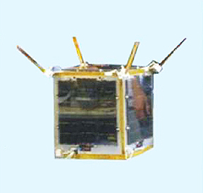
Στο μοντέλο της εικόνας διακρίνονται τα 3 παγχρωματικά τηλεσκόπια
Το διαστημικό όχημα είναι προσανατολισμένο στη χαρτόγραφηση αφού φέρει τρεις παγχρωματικές κάμερες στερεοαπεικόνισης και έναν υπέρυθρο σαρωτή (IRMSS). Οι κάμερες αυτές είναι τοποθετημένες με τέτοιο τρόπο ώστε να λαμβάνουν εικόνα στο ναδίρ με 2.1μ ανάλυση (πλάτος σκηνής 51,1χλμ) αλλά και να είναι δυνατή η εμπροσθοσάρωση και η οπισθοσάρωση σε 3,5μ ανάλυση (πλάτος σκηνής 52,3). Η συσκευή  IRMSS θα καταγράφει εικόνες στο υπέρυθρο με ανάλυση 6,0μ και πλάτος σκηνής 51,0χλμ. Ο δορυφόρος έχει μάζα 2.630χλγρ., η τροχιά του βρίσκεται σε μέση απόσταση 505,984χλμ από τη Γη και για την τροφοδοσία του διαθέτει ηλιακούς συλλέκτες μήκους 3 μέτρων.

Ο ZiYuan-3 έχει σχεδιαστεί για διάρκεια ζωής 4 ετών προκειμένου να συμβάλει στη γεωμορφολογική έρευνα, στην αντιμετώπιση φυσικών καταστροφών, στη διαχείριση των υδάτων, στη χωροταξία κλπ. Θα διαχειρίζεται από το Κέντρο Παρατήρησης Γης της Κινεζικής Ακαδημίας Επιστημών της Κίνας και από το Εθνικό Ινστιτούτο Διαστημικό Ερευνών της Βραζιλίας. 

Ο VesselSat-2
Με την ίδια αποστολή τέθηκε σε τροχιά και ο βάρους 28χλγ μικροδορυφόρος VesselSat-2 λουξεμβουργιανής κατασκευής (LuxSpace Sarl) προκειμένου να ενσωματωθεί στο στόλο της ORBCOMM Inc. και σκοπό να εξυπηρετήσει τη συλλογή και διαχείριση πληροφοριών θαλασσίων μεταφορών μέσω του συστήματος AIS στην περιοχή του Ισημερινού.

Τετάρτη 4 Ιανουαρίου 2012

REAL TIME SATELLITE TRACKING

Πολλές φορές έχουμε είτε την απορία είτε την περιέργεια είτε ακόμα και την ανάγκη να μάθουμε ή να προβλέψουμε της θέση ενός δορυφόρου. Κυρίως βέβαια μας ενδιαφέρει πότε ήταν ή πότε θα βρίσκεται ο δορυφόρος πάνω από ένα γεωγραφικό τόπο.

Στη ιστοσελίδα www.n2yo.com βρήκαμε ένα εύχρηστο και κατά το δυνατό πλήρες εργαλείο παρακολούθησης αντικειμένων σε τροχιά γύρω από τη Γη. Η ιστοσελίδα αντλεί τις πληροφορίες από το Δίκτυο Παρακολούθησης Διαστήματος της πολεμικής αεροπορίας των ΗΠΑ και λειτουργεί από τη Διοίκηση Διαστήματος. Ως απλός επισκέπτης του ιστοχώρου μπορέσαμε εύκολα να εντοπίσουμε τη θέση διαφόρων δορυφόρων οι οποίοι μπορούν να αναζητηθούν βάση του ονόματος, της ημερομηνίας εκτόξευσης ή του σκοπού τους. Η θέση προβάλλεται με υπόβαθρο Google Maps, ενώ δίνονται πληροφορίες σε πραγματικό χρόνο (1sec) για τη θέση, την ταχύτητα, το ύψος, τη γωνία κλπ του συστήματος που παρακολουθούμε. Μετά από τη δωρεάν εγγραφή μας μπορέσαμε:

O Pleiades1 (επάνω) πετά μπροστά από τον Geoeye1
  • Να δημιουργήσουμε και αποθηκεύσουμε ομάδες δορυφόρων που ανακτούμε σε μελλοντικές επισκέψεις.
  • Να επιλέξουμε πολλά συστήματα και να απεικονίσουμε ταυτόχρονα την τρέχουσα θέση τους.
  • Να καταχωρήσουμε ένα επίγειο σημείο παρατήρησης.
  • Να εξετάσουμε τη τροχιά δορυφόρων για τα επόμενα πέντε 24ωρα.
Έτσι εντοπίσαμε τον Geoeye1 να πετά λίγα δευτερόλεπτα μπροστά από τον ολοκαίνουργιο Pleiades1 πάνω από την χερσόνησο Καμτσάτκα στην ίδια ανοδική τροχιά, ενώ μπήκαμε στο πειρασμό να δούμε που θα βρίσκεται στις επόμενες 5 ημέρες ο στρατιωτικός δορυφόρος παρατήρησης Helios1B σε σχέση με την επίγεια θέση παρατήρησης και με βήμα του ενός λεπτού. 

Ο στρατιωτικός Helios1B το πτωί του  Σάββατο 7 Ιαν θα βρίσκεται πάνω από τη Γεωργία, τη Μ.Θάλασσα, το Ιράν και τη Σ.Αραβία. Θέση επίγειας παρατήρησης Αθήνα.

Η ιστοσελίδα παρέχεται χωρίς κόστος με δυνατότητα δωρεάς ποσού για την κάλυψη των αδειών χρήσης λογισμικών τρίτων.

Ο Κινεζικός δράκος εκτοξεύεται

H Κίνα θα υλοποιήσει 5 εμπορικές αποστολές συνολικά 6 δορυφόροων μέσα στο 2012 για λογαριασμό πελατών της, σύμφωνα με τον πρόεδρο της China Great Wall Industry Corp. Στις εκτοξεύσεις αυτές περιλαμβάνονται:
  • Δύο μικροδορυφόροι του Λουξεμβούργου για την παρατήρηση της θάλασσας που θα εκτοξευθούν από αεροσκάφος,
  • Δύο τηλεπικοινωνιακοί δορυφόροι του Χόνγκ-Κόνγκ.
  • Δύο δορυφόροι παρατήρησης Γης (τηλεπισκόπησης).
Κάθε χρόνο πραγματοποιούνται παγκοσμίως 20-30 εμπορικές διαστημικές πτήσεις, οι περισσότερες από τη Ρωσία και την Ευρώπη, επομένως ο συγκεκριμένος προγραμματισμός για το 2012 δίνει στην χώρα το 15% του μεριδίου της παγκόσμιας αγοράς  εμπορικών διαστημικών πτήσεων. Το 2011 οι κινεζικές εμπορικές εκτοξεύσεις ανήλθαν σε 3 και περιελάμβαναν μία αποστολή για τον τηλεπικοινωνιακό δορυφόρο της Νιγηρίας, μία για την αποστολή του κινεζικού τηλεπικοινωνιακού δορυφ. του Πακιστάν και μία τρίτη για την αποστολή του γαλλικού τηλ. δορυφ. της Thales Alenia Space για την εταιρία τηλεπικοινωνιών Eutelsat.  

Στα αμέσως επόμενα χρόνια στο πελατολόγιο της η China Great Wall Industry Corporation περιλαμβάνονται η Λευκορωσία, η Βενεζουέλα, η Βολιβία και το Τουρκμενιστάν, που έχουν ήδη υπογράψει τις σχετικές παραγγελίες.

Το 1999 οι ΗΠΑ απαγόρευσαν την πώληση υλικού διαστημικής τεχνολογίας στην Κίνα, και δεδομένου ότι οι αμερικάνοι κατασκευαστές κυριαρχούσαν τότε στη διεθνή αγορά διαστημικών συστημάτων, απόκλεισαν την Κίνα από τις εμπορικές διαστημικές δραστηριότητες.  Το 2005 αυτό άλλαξε κι έτσι οι κινέζοι μπόρεσαν να εξυπηρετήσουν πελάτες που ζητούσαν εκτοξεύσεις δορυφόρων ευρωπαϊκής κατασκευής με υλικά και συστήματα αμερικάνικης προέλευσης.

Τέλος στα σχέδια της Κίνας για την τρέχουσα δεκαετία περιλαμβάνεται και  το δορυφορικό σύστημα πλοήγησης  Beidou (Πυξίδα) που θα διαθέτει υπηρεσίες πλοήγησης, γεωεντοπισμού, χρονισμού και ανταλλαγής γραπτών μηνυμάτων για την περιοχή της Ασίας και του Ειρηνικού.

Παρασκευή 30 Δεκεμβρίου 2011

Διαστημική Κίνα: Ziyuan I-02C

Την περασμένη εβδομάδα η Κίνα  έθεσε σε τροχιά το δορυφόρο τηλεπισκόπησης Ziyuan I-02C. Η εκτόξευση πραγματοποιήθηκε με πύραυλο Long March-4B (LM-4B)που εκτοξεύθυκε από το κέντρο εκτόξευσης TSLC (Taiyuan Satellite Launch Center) γνωστό ως Βάση 25 στην επαρχία Κελάν της περιφέρειας Σάντσι.
Η εκτόξευση του Long March 4B
 Ο Ziyuan I-02C έχει σχεδιαστεί και κατασκευαστεί στην Κίνα από την Κινεζική Ακαδημία ΔιαστημικήςΤεχνολογίας και από όσα έως σήμερα είναι γνωστά αποτελεί το πρώτο κινεζικό μη στρατιωτικό σύστημα παρατήρησης Γης υψηλής ανάλυσης.
Ο δορυφόρος τέθηκε σε τροχιά 13 λεπτά μετά από την εκτόξευση που πραγμοτοποιήθηκε στις 11.26π.μ. την Τετάρτη 22 Δεκεμβρίου  2011. Έχει περίοδο 110,15 λεπτά, πολική γωνία 98,56ο, απόγειο και περίγειο 770 και 761 χιλιόμετρα αντίστοιχα.

Η 1η εικόνα του Ziyuan I-02C.
Το σύστημα αποτελεί αναβάθμιση του κινεζο – βραζιλιάνικου δορυφόρου παρατήρησης Γης CBERS (China Brazil Earth Resources Satellite) ή αλλιώς ZY 1 (Zi Yuan). Για τη συλλογή δεδομένων, εκτιμάται ότι διαθέτει δύο κάμερες υψηλής ανάλυσης 2,36μ με πλάτος σάρωσης 54 χιλιόμετρα και μία παγχρωματική κάμερα διπλής ανάλυσης 5μ και 10μ, με πλάτος σκηνής 60 χιλιόμετρα. Επίσης από την 1η εικόνα που κατέγραψε το σύστημα στις  23-12-2011 προκύπτει ότι υπάρχει ένας πολυφασματικός σαρωτής ανάλυσης 20-120 (;) μέτρων με δυνατότητα καταγραφής στο οπτικό και το εγγύς υπέρυθρο, πιθανότατα ίδιος με εκείνον του CBERS-2B, ενώ πιστεύεται πως υπάρχει και θερμικός ανιχνευτής.

Πέμπτη 29 Δεκεμβρίου 2011

Συνεργασία Βιετνάμ - Ιαπωνίας


Η Βιετναμέζικη Ακαδημία Επιστημών και Τεχνολογίας (VAST) ανακοίνωσε την πρόθεσή της να κατασκευάσει ένα διαστημικό κέντρο έως το 2018 σε συνεργασία με την ΙαπωνικήΥπηρεσία Αεροδιαστημικών Ερευνών (JAXA). Το κέντρο που αναμένεται να κοστίσει $600εκατ., θα δημιουργηθεί στο Τεχνολογικό Πάρκο Hoa Lac, 30 χιλιόμετρα από το Ανόι και θα καταλαμβάνει έκταση 90 στρεμμάτων. 
Σκοπός του κέντρου θα είναι η ενίσχυση της  έρευνας και η κατασκευή μικρών δορυφόρων με αντικείμενο τη μετεωρολογία, τη γεωδαισία, τις επιχειρήσεις έρευνας και διάσωσης καθώς και την εκπομπή ραδιοτηλεοπτικών προγραμμάτων. Η κυβέρνηση του Βιετνάμ, μετά τη λειτουργία του κέντρου, ελπίζει πως θα μειώσει κατά 10% τις δαπάνες για την αντιμετώπιση των φυσικών καταστροφών.

Δευτέρα 19 Δεκεμβρίου 2011

Σε τροχιά ο Pleiades-1

Την περασμένη Παρασκευή 16 Δεκεμβρίου, εκτοξεύτηκε με επιτυχία από τη Γαλλική Γουινέα πύραυλος Soyuz με φορτίο 6 δορυφόρων. Η με αύξοντα αριθμό 1871 πτήση Soyuz και κωδικό VS02 ολοκλήρωσε την αποστολή σε 3 ώρες και 26 λεπτά σε ύψη από 610 έως 700 χιλιομέτρων θέτοντας σε τροχιά 6 δορυφόρους, δύο παρατήρησης Γης και τέσσερις στρατιωτικών εφαρμογών (ELISA) ωφέλιμου φορτίου 1400 κιλών. Έτσι ο στόλος των δορυφόρων παρατήρησης Γης υψηλής ανάλυσης (VHR) εμπλουτίζεται από το Χιλιανό σύστημα SSOT και το Γαλλικό Pleiades-1. 

Η Ευρώπη εισέρχεται δυναμικά στην αγορά των εικόνων χωρικής ανάλυσης κάτω του μέτρου καθώς ο βάρους 970 κιλών Pleiades-1 θα μπορεί να καταγράφει εικόνες στο παγχρωματικό του κανάλι (480-830nm) σε χωρική ανάλυση 0,7μ (0,5μ ύστερα από επεξεργασία δεδομένων στη Γη) και 2,0μ στα τέσσερα πολυφασματικά κανάλια (Blue 430-550nm, Green 490-610nm, Red 600-720nm & NIR 750-950nm). 

Ο δορυφόρος θα βρίσκεται σε τροχιά μέσου ύψους 694 χιλιομέτρων από την επιφάνεια της Γης με μέγιστη θεωρητική δυνατότητα σάρωσης 1.000.000 τετραγωνικών χιλιομέτρων ανά 24 ώρες και πραγματική βέλτιστη δυνατότητα σάρωσης 300.000 τετραγωνικών χιλιομέτρων ανά 24 ώρες, ενώ θα υπάρχει η δυνατότητα λήψης ζεύγους ή τριάδας στερεοσκοπικών εικόνων (stereo/tri-stereo).  

Το σύστημα κατασκευάστηκε από την EADS-Astrium ενώ τα αποκλειστικά δικαιώματα διανομής για ολόκληρο τον κόσμο θα έχει η γαλλική SPOT Image.
Εντός του 2012 αναμένεται και η εκτόξευση του δίδυμου Pleiades-2, κάτι που θα δώσει τη δυνατότητα λήψης εικόνας για κάθε περιοχή του πλανήτη ανά 24 ώρες. 

Οι υπεύθυνοι του προγράμματος φιλοδοξούν να ανταγωνιστούν τις ΗΠΑ που έως σήμερα μονοπωλούν την αγορά εμπορικά εκμεταλλεύσιμων εικόνων πολύ υψηλής ανάλυσης μέσω των εταιριών Digital Globe (Quickbird, Worldview1 & Worldview2) και  Geoeye (Ikonos, Geoeye1).

Τετάρτη 7 Δεκεμβρίου 2011

Χιλιανός δορυφόρος παρατήρησης Γης

Το Χιλιανό Δορυφορικό Σύστημα για την Παρατήρηση της Γης (Sistema Satelital para Observacion de la Tierra), αποτελεί πρόγραμμα του Χιλιανού Υπουργείου Άμυνας και θα χρησιμοποιηθεί τόσο για στρατιωτικούς και για πολιτικούς σκοπούς της χώρας. Το σύστημα κατασκευάζεται από την EadsAstrium, ενώ περιλαμβάνει εκτός από το δορυφόρο, επίγειο σταθμό λήψης και μονάδα επεξεργασίας εικόνων που θα εγκατασταθούν στη Χιλή.

Ο δορυφόρος αναμένεται να εκτοξευθεί στις 16-12-2011 από τη Γαλλική Γουινέα από την Arianspace με πυραυλικό όχημα Soyuz μαζί με το γαλλικό δορυφόρο πολύ υψηλής ανάλυσης Pleiades και άλλα τέσσερα στοιχεία του συστήματος ELISA.

Το σύστημα παρατήρησης βάρους 130 κιλών SSOT, θα καταγράφει παγχρωματικές και πολυφασματικές εικόνες (μπλε, πράσινο, κόκκινο και εγγύς υπέρυθρο) των 10bit με 1,45 και 5,80 μέτρα ανάλυση αντίστοιχα, από απόσταση 620 χιλιομέτρων από την επιφάνεια της Γης, με περίοδο 97,23 λεπτά της ώρας και τροχιακή ταχύτητα 7,54 χλμ/ώρα.

Πέμπτη 24 Νοεμβρίου 2011

Landsat 5. To Τέλος Μιας Εποχής

Ο μακροβιότερος δορυφόρος παρατήρησης Γης Landsat 5, που προσέφερε για περισσότερο από 27 χρόνια τις υπηρεσίες του στην παγκόσμια  επιστημονική κοινότητα καταγράφοντας και μεταδίδοντας πολυφασματικές και θερμικές εικόνες από ολόκληρο τον πλανήτη, φαίνεται πως ολοκληρώνει την αποστολή του. Παρόλο που σχεδιάστηκε για μόλις 3 χρόνια διάρκεια ζωής, κατάφερε να ξεπεράσει κάθε προηγούμενο, καθώς από το 1984 καταγράφει και μεταδίδει εικόνες.

Στις 18 Νοεμβρίου 2011 σταμάτησε η μετάδοση δεδομένων από το δορυφόρο στους επίγειους σταθμούς, κάτι που οφείλεται σύμφωνα με τους υπεύθυνους του προγράμματος της Γεωλογικής Υπηρεσίας των ΗΠΑ, στα γερασμένα ηλεκτρονικά μέρη του συστήματος. Παρά τις προσπάθειες που καταβάλλονται. Οι επιστήμονες σε μια ύστατη προσπάθεια ανάκτησης του συστήματος αποφάσισαν να διακόψουν την καταγραφή εικόνων για ένα διάστημα 90 ημερών και να προχωρήσουν σε δοκιμές, προτού θέσουν οριστικά το σύστημα εκτός λειτουργίας.
Ο Landsat5 που εκτοξεύθηκε την 1 Μαρτίου 1984, ήταν ο μόνος δορυφόρος του προγράμματος Landsat σε επιχειρησιακή λειτουργία, ύστερα από την αποτυχία του Landsat6 να τεθεί σε τροχιά και το πρόβλημα σάρωσης γραμμών του Landsat7 που παρουσιάστηκε το 2013.
Το πρόγραμμα Landsat5  έχει δημιουργήσει ένα ανεκτίμητο αρχείο καταγραφής του περιβάλλοντος, με πληροφορίες για τη δασοκάλυψη, τις χρήσεις γης, την ερημοποίηση, τις υδάτινες μάζες κ.α.
Η Γεωλογική Υπηρεσία των ΗΠΑ, προγραμματίζει την εκτόξευση του Landsat 8, (προς το παρών με την ονομασία Landsat Data Continuity Mission) τον Ιανουάριο του 2013. 
Η διάθεση δεδομένων Landsat 5 είναι ελεύθερη από τον ιστότοπο Earth Explorer.

Τρίτη 6 Σεπτεμβρίου 2011

Nigerian-built satellite acquires first image just days after launch 26/8/2011

The Nigerian-built satellite, NigeriaSat-X, has acquired its first satellite image just three days after the successful launch on 17th August.


Revealing buildings and the landscape surrounding the city of Auckland, New Zealand, this image demonstrates that the satellite’s enhanced 22m wide-area multi-spectral imagery for mapping, agricultural monitoring and disaster relief programmes works well.

NigeriaSat-X was built by engineers from Nigeria’s National Space Research and Development Agency (NASRDA) under the supervision of Surrey Satellite Technology Ltd (SSTL). The new generation of Nigerian scientists and engineers trained up under the NigeriaSat-X project will continue to support Nigeria’s space programme, ensuring its continued success and sustainability. In total, 26 Nigerian engineers were located at SSTL’s facilities in Guildford for 18 months throughout the design and test phases.

Currently two joint NASRDA-SSTL teams are working in parallel in Abuja and Guildford to commission NigeriaSat-X and NigeriaSat-2, which was launched at the same time. After the initial commissioning phase is complete, the NASRDA team in Guildford will return to Nigeria to continue NigeriaSat-X operations from the Abuja ground station.

SSTL Executive Chairman, Sir Martin Sweeting, commented, "NigeriaSat-X is the product of Nigeria’s training and development programme here at Surrey. It is a great credit to NASRDA and their engineers that this satellite is performing well and its operations are progressing so quickly. These highly skilled engineers will not only help Nigeria to manage its resources, but also bootstrap its fledgling high tech economy alongside a growing nucleus of highly trained people.”

The launch of NigeriaSat-X adds a third 22m imager to the seven-satellite Disaster Monitoring Constellation that is coordinated by DMC International Imaging Ltd (DMCii) to provide governmental and commercial imaging campaigns.

About SSTL

Surrey Satellite Technology Limited (SSTL) is the world's leading small satellite company, delivering operational space missions for a range of applications including Earth observation, science and communications. The Company designs, manufactures and operates high performance satellites and ground systems for a fraction of the price normally associated with space missions, with over 350 staff working on turnkey satellite platforms, space-proven satellite subsystems and optical instruments.

Since 1981 SSTL has built and launched 36 satellites, as well as providing training and development programmes, consultancy services and mission studies for ESA, NASA , international governments and commercial customers, through an innovative approach that is changing the economics of space.

Based in Guildford, UK, SSTL is owned by EADS Astrium NV.